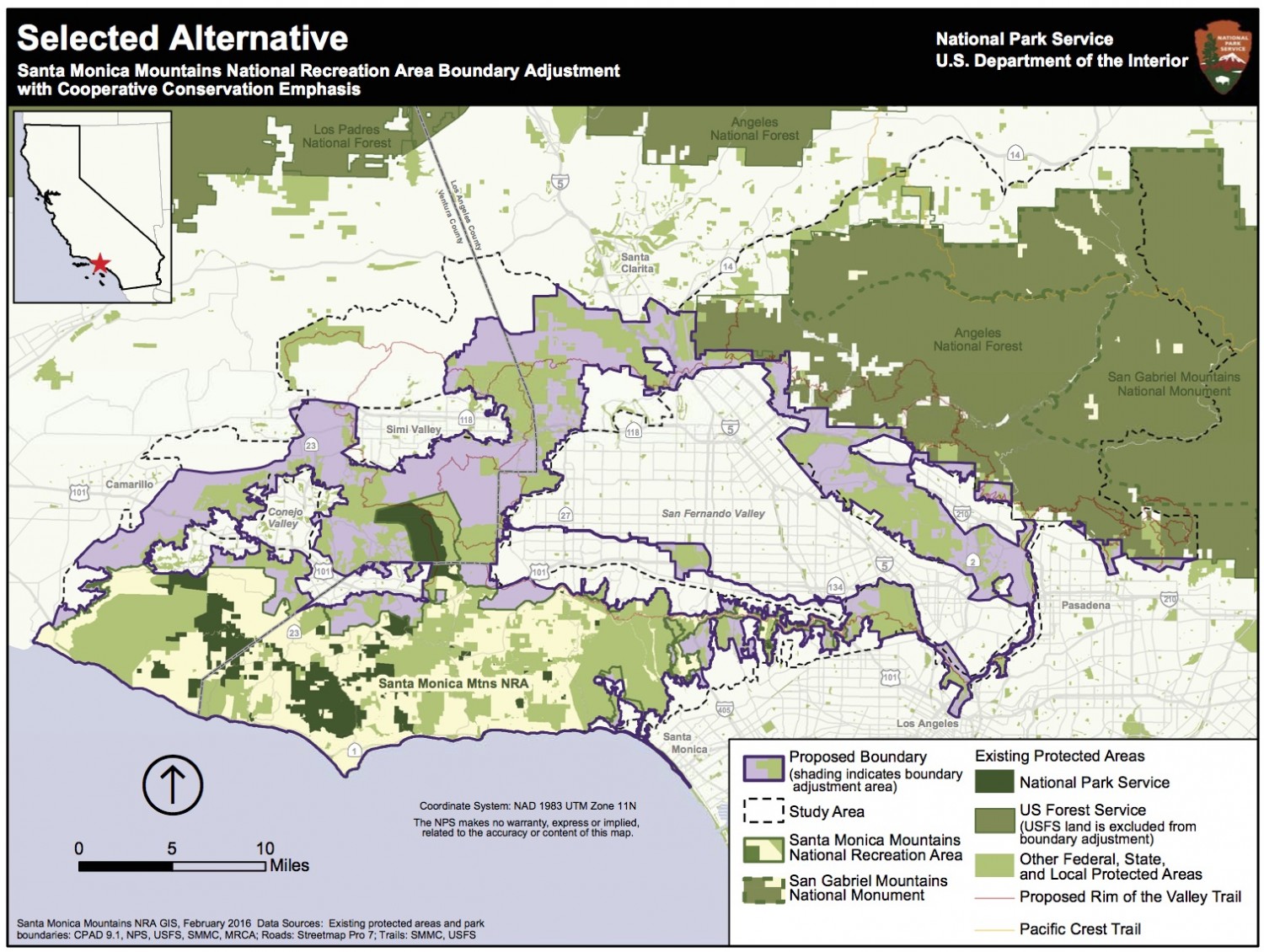

Selected Alternative – Click on the map above for a full screen version.
The National Park Service’s final study recommendation, or “selected alternative,” is essentially a combination of possible alternatives proposed in the Rim of the Valley Corridor Draft Special Resource Study and Environmental Assessment released in April 2015. The selected alternative proposes a 170,000-acre boundary adjustment to SMMNRA, which would include portions of the Los Angeles River and Arroyo Seco corridors, the Verdugo Mountains-San Rafael Hills, the San Gabriel Mountains foothills, the Simi Hills, the Santa Susana Mountains, and the Conejo Mountain area.”

Alternative D: Click on the map above for a full screen version.
Regional Rim of the Valley Boundary Adjustment and Cooperative Conservation Areas, a SMMNRA boundary adjustment (approximately 313,000 acre addition) with an emphasis on protecting regional wildlife corridors, would add most areas within Rim of the Valley Corridor (excluding U.S. Forest Service managed areas) to SMMNRA. Cooperative conservation approaches would also be recommended for key habitat linkages between Rim of the Valley Corridor study area and the Los Padres and Angeles national forests.

Alternative C: Click on the map above for a full screen version.
Rim of the Valley Boundary Adjustment, a SMMNRA boundary adjustment (approximately 173,000 acre addition) that would provide more parks and protect habitat linkages, with an emphasis on creating more recreational opportunities near urban areas.
Alternative B: Cooperative Conservation Partnership would foster cooperative planning and funding tools for the NPS, partner agencies and landowners in the Rim of the Valley Corridor and key habitat linkages to the Los Padres and Angeles national forests (no new areas would be added to the SMMNRA).
Alternative A: Continuation of Current Management